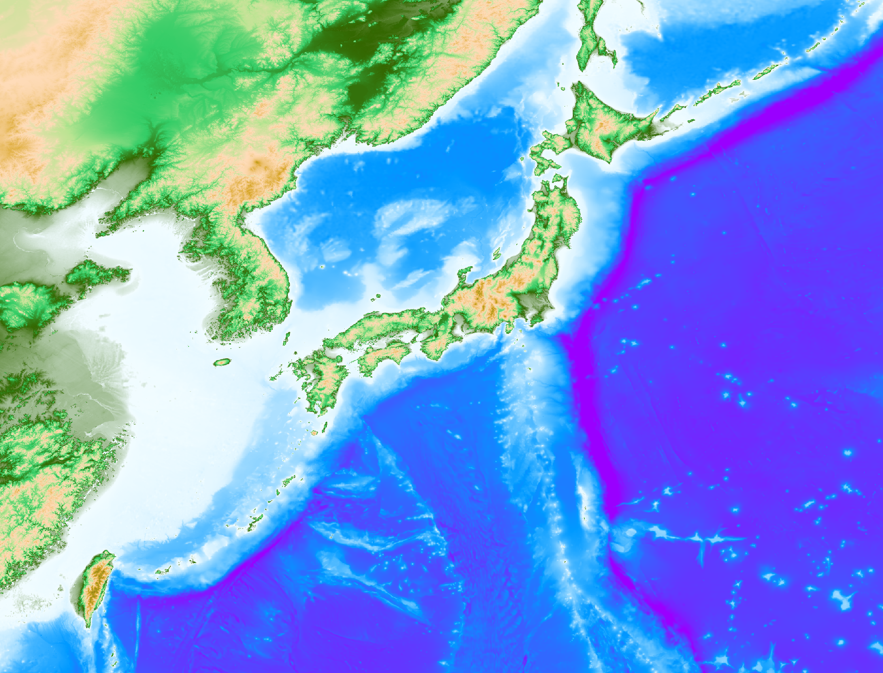
Global tsunami Terrain Model
In the OpenTSUNAMI-kiyuu project, Global tsunami Terrain Model (GtTM) with one arc-second nesting grid will be constrcted using the finest resolution open data for the tsunami inundation calculation on any coast.
When you use this date, please cite doi:10.17598/NIED.0021 as N. Chikasada (2020).
Whole Japan (two arc-second)
It covers whole Japan of E117-155, N20-49 (68401 x 52201 px) with two arc-second (about 50 m) flat resolution. The GtTM Whole Japan grid has been compiled with some original resources. For the western region, especially the Nankai Trough region, nesting grid data generated by CAO (Cabinet Office, Japan; 2016) and distributed by G-spatial information Center are used. For the eastern region, where covers the Kril trench, the Japan Trench and Izu bonin, nesting grid data genrated by CAO (2016) and distributed by G-spatial information Center are used. For the other regions, GEBCO 2019 Grid data (mirror in this site) is used with over sampling. For further details, please see the attached document (only Japanese).
TwDB related DEM
These covers three regions that are eastern Japan, Nankai Trough and Japan sea resions trimed from WholeJapan to calculate waveforms in TwDB.
- Eastern Japan (E138-E150, N31-N46) Download eastJapan.grd (2.2 GB) »
- Nankai Trough (E130-E142, N30-N36) Download nankaiTrough.grd (0.9 GB) »
- Japan Sea (E127-E142, N33.7-N45.7) Download japanSea.grd (2.2 GB) »
Tonga
By convining high resolution topography ASTER GDEM (1 arc-sec) and bathymetry GEBCO (30 arcsec),
homogeneous DEM which covers the Hunga Tonga - Hunga Ha'apai volcano and Tongatapu island are generated (W176-W174, S22-S19) with 1 arc-sec resolution.
 Download tonga.grd (0.3 GB) »
Other DEM
GEBCO provids global bathymetry data. You can also download from mirror in this site. The newest release (the GEBCO_2020 grid) has been released in GEBCO site. Both data are a global terrain model for ocean and land with 15 arc-seconds resolution. Download GEBCO_2019.zip (10.9 GB) »
Due to ASTER GDEM download site temporarily unavailable, the mirror site is open on this site. You can download each one degree square DEM data whose filename refere to the latitude and longitude at the geometric center of the lower-left (southwest) corner pixel. To see the map, please set small font in your browser. Open Map »
Licence, Acknowledgment and other information
This data is licensed under a Creative Commons Attribution 4.0 International License, which permits use, sharing, adaptation, distribution and reproduction in any medium or format, as long as you give appropriate credit to Naotaka CHIKASADA 2020 and the source, provide a link to the Creative Commons licence, and indicate if changes were made. To view a copy of this licence, visit https://creativecommons.org/licenses/by/4.0/. Please cite doi:10.17598/NIED.0021 as Chikasada, N. (2020).
We thank GEBCO (General Bathymetric Chart of the Oceans) for providing the great ocean bathymetric data under convenient terms of use.
謝辞
本データの作成には,内閣府 南海トラフの巨大地震モデル検討会によって作成され, G空間情報センターによって配布されているデータ及び, 内閣府中央防災会議資料による日本海溝・千島海溝周辺海溝型地震に関する専門調査会 によって作成され, G空間情報センターによって配布されているデータを使用しています. 記して感謝致します.
本データの作成はJSPS科研費 JP18K04674と JP19H02409 の助成を受けたものです. また,公益財団法人日立財団 倉田奨励金(奨励金No.1400)の助成を受けて作成中です.
